
Location & Size
The Ga East Municipal Assembly is located at the northern part of Greater Accra Region. It is one of the Sixteen (16) Districts in the Greater Accra Region and covers a Land Area of about 96 sq km. The capital of the Municipal Assembly is Abokobi. The Assembly is boarded on the west by the Ga West Municipal Assembly (GWMA), on the east by the La-Kkwantanang Municipal Assembly (LaNMA), the south by Accra Metropolitan Assembly (AMA) and the north by the Akwapim South District Assembly. The Municipality is sub divided into two administrative as Zonal Councils. Namely the Abokobi Zonal Council and the Dome Zonal Council.
Topology & Drainage
The Assembly’s land area consists of gentle slopes interspersed with plains in the west. The Akwapim range rises steeply above the western end and lies generally at 375-420m north of Aburi and fall to 300m southward. There are a few rivers and seasonal streams most of which are threatened by human activities. This included the Siseme stream at Sesemi and the Dakobi at Ajako. Other small ponds exist at Abloradjei, Sesemi, and Old Ashongman. Most of these ponds are also threatened by human activities and the Assembly has to make conscious efforts to preserve them for agricultural use. The Municipality also has a lot of ground water which has been tapped to provide potable water for the rural communities and small towns.
Climate & Vegetation
The Municipality falls in the savannah agro-ecological zone. Rainfall pattern is bi-modal with the average annual temperature ranging between 25.1oc in August and 28.4oc in February and March. February and March are normally the hottest months. The Assembly has two main vegetation namely shrub lands and grassland. The shrub lands occur mostly in the western outskirts and in the north towards the Aburi hills and consist of dense cluster of small trees and shrubs that grow to an average height of about five meters.
The grassland which occurred to the southern parts of the municipality has now been encroached upon by human activities including settlements.
Geology & Soil
Land Tenure System
Land in the Municipality is owned by chiefs, clan or family heads who hold them in trust for their subjects. However, land could also be acquired through direct purchase, rental, leasehold and share cropping (nnoboa). The fact that these parcels of land could be inherited through parents or grandparents has led to a lot of sale and resale of land with its attendant land litigations and chieftaincy disputes.
This situation has also contributed to the rapid loss of farm lands with its attendant unemployment and subsequent migration to the urban areas.
Condition of the Built Environment
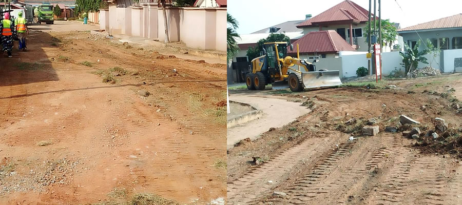
The built environment in the Municipality leaves much to be desired. Building regulations are broken with impunity and it is posing very serious consequences for the land use pattern. Over 70% of developers used quality building materials and as such produce good housing quality.
However, many Gutters are chocked with garbage, creating stagnant water which breeds mosquitoes and floods the result is the high incidence of malaria and loss of life and properties during raining season. erosion is widespread in most communities in the Municipality due to lack of proper drainage systems, lack of settlement planning, excessive sewerage of the surrounding, lack of tree cover and landscaping are the main causes.
Date Created : 11/28/2017 5:02:16 AM


 facebook
 X
X
 Youtube
 instagram
 +233 593 831 280
 0800 430 430
 GPS: GE-231-4383
 info@ghanadistricts.com
 Box GP1044, Accra, Ghana