
Location & size
The Tain District is one of the newly created Districts in June 2004, in the Brong Ahafo Region. It is situated at the North West of Sunyani (Regional Capital). It lies within latitudes 7 ½ and 8.45° North and longitudes 2.52°West and 0.28° East. In terms of land area, Tain District covers 4,125 sq kilometers.
The district shared common boundaries with Wenchi Municipal to the East, Jaman North to the West, Sunyani Municipal to the South and Berekum Municipal to the South West. It is also bounded by the Bole District of the Northern Region to the North East and La Cote d’Ivoire to the North West.
Nsawkaw, the district capital is 18 miles from Wenchi, the capital of Wenchi Municipal which Tain was carved out.The location of the big towns like Debibi, Brodi, Seikwa and Badu are far away from the district capital, Nsawkaw, and nearer Districts like Berekum, Sampa and Sunyani deprive the district of the needed revenue as the big towns in Tain District transact business with these near by districts.
Topology & drainage
Generally, the district is well drained. The Black Volta marks the northern boundary of the district with the Northern Region. The tributary rivers which serve the communities in the district are Tain, Nyampanie while some of the streams dry up in the dry season, the major river flow throughout the year.
Ground water potential in the district is highly variable. Much depends on the nature of the underlying rock formations and rainfall. The present combination of the lack of water storage in the wet season, heavy run-off, high evaporation and low infiltration rates to charge aquifers in some areas contribute to water deficiencies hampering human settlement and increased agricultural production. There is therefore ground water in Tain and Volta.
Climate & vegetation
The Tain District spans the moist-semi-deciduous forest and the Guinea Savannah woodland vegetation zones. The Guinea Savannah woodland represents an eco-climatic zone which has evolved in response to climatic and edaphic limiting factors and has been modified substantially human activity.
The original forest vegetation has been subjected to degradation, caused mainly by the indiscriminate bush fires, slash and burn agriculture, logging and felling of trees for fuel over the years.
The cumulative effect is that secondary vegetation occurs in cultivated areas. Timber species like Odum, Sapele, Wawa and Mahogany are found in places such as Dorbor and Bungase.In the semi-derived savanna areas, there are the absence f large economic trees as a result of logging, charcoal burning and mechanized farming.
The grooves show that with protection, forest in the area can be productive because the soils in the sacred groves appear more fertile compared to soils lying a few metres away which have been laid bare by intensive cultivation and other unsustainable uses.
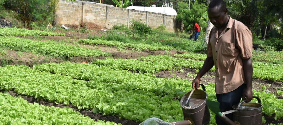
In the grooves, wildlife like deer and antelope are found there. Other forest reserves are Sawsaw, Yaya and Bawa watershed are found in the district. The combination of the vegetation zones – guinea savannah, transitional zone and the forest permit the cultivation of a variety of crops – cereal, tubers and vegetables and even animal rearing.
The prevailing climatic conditions in the district constitute important parameters for development. Climate for example, has some influence on the quality and quantity of land cover. Similarly, rainfall and available moisture content are vital factors for existing potential resources use in the district.
The temperature in the Tain District is generally high averaging about 24.5°C (779°F) throughout the year (Benneh and Dickson, 1970). Average maximum temperature is 30.9°C and minimum of 21.2
Date Created : 11/29/2017 3:40:11 AM


 facebook
 X
X
 Youtube
 instagram
 +233 593 831 280
 0800 430 430
 GPS: GE-231-4383
 info@ghanadistricts.com
 Box GP1044, Accra, Ghana