

location and Size
The district is located between Longitude 1.50W, latitude 1.4 N and Longitude 1.5W latitude 6.30 N. The district therefore falls within a typical Tropical Region of Africa, which characteristically experiences high temperatures and high rainfall throughout the year. This puts the Adansi North District into a Semi-Equatorial climatic region.
Aesthetically, the district is a very beautiful area to visit. The Kusa scarp which is a range of mountains influences almost all parts of the district and is a very beautiful site to watch. Again, out of the Kusa scarp, a very beautiful waterfall known as Nyankomasu waterfalls has been developed and is already attracting tourists from far and near to the site which the Assembly can harness to improve upon its revenue base.
Adansi North District has the following as some of its major towns: Fomena, the capital, Dompoase, Asokwa Junction, Nyankomasu, Tewobaabi, Fumso, Akrokerri, Kyekyewere, Aboabo, Nsokote and others. The District covers an area of approximately 853.63 sq. km representing about 4.7% of the total area of Ashanti Region. The district is bounded in the South –West by Obuasi District, in the South by Adansi South District, in South-East by BosomeFreho District, in the North-East by Bekwai District and by West Amansie Central District.
The district has an undulating terrain with more than half of the total area rising to an average height of about 300 meters above sea level. The district has several streams depicting a typical dendritic pattern. Major streams in the district are: Bemin, Fum, Gyimi, Kyeabo, Ankafo, Adiembra, Asabri, Subine, Konwia, Kyekye, Atraime, etc. Most of these rivers are used for domestic and industrial purposes. Most of them are perennial. As a result of this, farmers cultivate vegetables during dry seasons, and this has helped many farmers to be in business throughout the year. The area consists of Tarkwain (pre Cambrian) and upper Birimian rocks noted for their mineral bearing potentials. Granitic rock outcrops occur at Akrokerri, Dompoase, Patakro and Kwapia. These rocks are quarried for constructional works such as building and road construction.
Most parts of the district lie within the Gold belt. Areas between Asokwa through Nyankomasu and Fumso Ketewa have been identified the District Assembly and Anglogold Ashanti, Obuasi as having gold and diamond deposits. Despite the presence of these rich resources, meaningful mining or extractional activities are yet to be carried out in the district. There is also sand belt that stretches from Fomena through Old Edubiase, Abadwum to Kwapia. This is also exploited for building and constructional works in the district and beyond.
Soil
The major soil types in the district are Forest Ochrosols which develop well under moderate rainfall between 900 mm and 1650 mm. They develop under forest vegetation. They are rich in humus content. The soils are well developed with well defined profiles. The soil supports meaningful agricultural production.
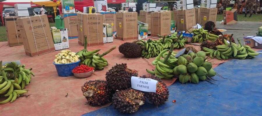
Cash Crops like Cocoa, Oil Palm and Citrus are cultivated by farmers from all parts of the district. In specific terms, ginger is cultivated in Old Ayaase, Coffee is also grown in areas around Bena. Vegetables such as pepper, tomatoes, garden eggs, etc are cultivated on a large scale in sandy soils around Akrokerri and Dadwen. The agricultural sector employs about 77% of the total labour force in the district. The district is divided into 37 sub-districts with regard to extension work. There are 17 extension officers in the district. The extension officer – farmer ratio in the district is more than 3500 farmers to one extension officer.
Some of the crops grown in the district are; Cocoa, Oil Palm, Citrus, Coffee, Maize, Cassava, Plantain, Cocoyam, Yam, Rice, Vegetables, Pineapple, etc. As is happening in other parts of the country, the agricultural sector in the district is facing so many problems. Some of these problems include; Lack of credit, Poor feeder road network, High cost of farm labour, difficulty in the acquisition of farm land (land tenure system), unattractive prices of farm produce, high cost of farm inputs, etc.
Climate
The district experiences semi-equatorial climatic conditions. Temperatures are generally high throughout the year with mean monthly temperatures ranging between 2600 C and 3000C. February and March are the hottest periods in the year. The mean annual temperature is 2700C. The annual total rainfall is between 1,250 mm and 1,750 mm. (50” – 70”). The major rains occur between April and July whilst the minor rains occur between September and December. Relative humidity is high about 80% in the rainy season and 20% in the dry season. The temperature and rainfall pattern enhance the cultivation of many food and cash crops such as cocoa, oil palm, citrus, vegetables, yams, cassava, cocoyam, cereals etc.
As a result of the double maximal rainfall pattern, there are two cropping seasons in a year: the major cropping season and the minor cropping season. The climate also supports forest vegetation which supports the growth of wood lots like odum, wawa, sapele etc. These are harvested for export to earn foreign exchange. Some are also used locally to create jobs for the people.
Date Created : 11/28/2017 2:40:48 AM





 facebook
 X
X
 Youtube
 instagram
 +233 593 831 280
 0800 430 430
 GPS: GE-231-4383
 info@ghanadistricts.com
 Box GP1044, Accra, Ghana