

PHYSICAL AND NATURAL ENVIRONMENT
a. LOCATION AND SIZE
The district is located between Longitude 1.50 W and latitude 6.30 N. The district therefore falls within a typical Tropical region of Africa, which characteristically experiences high temperatures and high rainfall throughout the year. This puts the Adansi North District into a Semi-Equatorial climatic region.
The Adansi North District covers an area of approximately 1140 sq km representing about 4.7% of the total area of Ashanti Region. The district is bounded in the South –West by Obuase District, in the South by Adansi South District, in South-East by Bosome Freho District, in the North-East by Bekwai District Assembly and in the West is Amansie Central District.
It has its capital at Fomena located on the Kumasi – Cape Coast main road. The district has 35 electoral areas and two constituencies (Fomena and Asokwa). The District has seven area councils i.e. Akrokerri, Anhwiaso, Asokwa, Bodwesango, Dompoase, Fomena and Fumso area Councils. There are 125 communities in the district.
b. CLIMATE
The district experiences semi-equatorial climatic conditions. Temperatures are generally high throughout the year with mean monthly temperatures ranging between 260 C and 300C .February and March are the hottest periods in the year. The mean annual temperature is 270C.
Double maxima rainfall regime is experienced in the district. The annual total rainfall is between 1,250 mm and 1,750 mm. (50” – 70”). The major rains occur between April and July whilst the minor rains occur between September and December. Relative humidity is high about 80% in the rainy season and 20% in the dry season. The temperature and rainfall pattern enhance the cultivation of many food and cash crops such as cocoa, oil palm, citrus, vegetables, yams, cassava, cocoyam, cereals etc.
As a result of the double maxima rainfall pattern, there are two cropping seasons, these are; the major cropping season and the minor cropping season in one year. The climate also supports forest vegetation which supports the growth of wood lots like odum, wawa, sapele etc. These are harvested for export to earn foreign exchange. Some are also used locally to create jobs for the citizens.
c. VEGETATION
Owing to the climatic conditions experienced in the district, the vegetation is naturally a semi-deciduous forest. This kind of vegetation is characteristically made up of three layers; namely the under growth, the middle layer and the upper layer.
It supports the growth of big and tall trees of different kinds which are not in pure stands. Some are hard wood others are soft. Examples are wawa, sapele, odum, mahogany etc
d. CONDITIONS OF THE NATURAL ENVIRONMENT
The Natural environment of the district originally was hilly, in terms of relief, and this was accompanied with rain forest vegetation.
The hills can still be seen throughout the district. In between the hills are valleys most of which contain streams. Unfortunately, about 80% of the rainforest vegetation in the district has been destroyed due to improper farming methods like slash and burn, bush fallowing, shifting cultivation, continuous cropping, plantation agriculture, etc.
The vegetation of the district has changed from its original rain forest vegetation to secondary forest vegetation.
Again bush fires and illegal chain saw operation have also contributed to the disappearance of the tall and giant trees which previously were in abundance in the district.
Despite the rapid change of the natural environment virgin forests, still exist in the district in the forest reserves which are a beautiful site to watch.
e. CONDITIONS OF THE BUILT ENVIRONMENT
Most of the communities in the district face serious problems with erosion due to the hilly nature of the district.
A community like Fomena the district capital, though an ancient town is not able to expand because, it is surrounded by hills and valleys. The people are therefore forced to build their houses close to each other without any regard to the planning scheme. The community just like many others in the district faces serious erosion. As a result, deep gullies are found in the town and the foundations of most buildings are exposed. Communities like Fumso, Brofoyedru, Nyankomasu and many others face similar situation.
F RELIEF AND DRAINAGE
The district has an undulating terrain with more than half the total area rising to an average height of about 300 meters above sea level. In general the district is located in a hilly area. For this reason though there is land, most of it is not available for use since they are hilly. Again the hilly nature of the land makes transportation difficult, since so many culverts have to be constructed on the roads to make them passable, which unfortunately is very costly, making a lot of the roads lack the facility, hence rendering them impassable during rainy seasons.
Generally, the district has several streams depicting a typical dendritic pattern. Major streams in the district are: Bemin, Fum, Gyimi, Kyeabo, Ankafo, Adiembra, Asabri, Subine, Konwia, Kyekye, Atraime, etc. Most of these rivers are used for domestic and industrial purposes. Most of them are perennial and the area is well drained. As a result of this, farmers cultivate vegetables during dry seasons, and this has helped many farmers to be in business throughout the year.
If this is encouraged, and irrigation facilities are provided for these farmers, it will help to improve upon the income levels of the people to help reduce poverty in the district.
g. SOIL TYPE AND AGRICULTURAL LANDUSE
The major soil types in the district are Forest Ochrosols which develop well under moderate rainfall between 900 mm and 1650 mm. They develop under forest vegetation. They are rich in humus content. The soils are well developed with well defined profiles. The soil supports meaningful agricultural production.
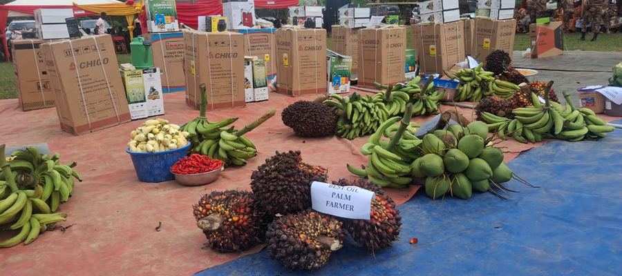
Cash Crops like Cocoa, Oil Palm and Citrus are cultivated by farmers from all parts of the district. In specific terms, ginger is cultivated in Old Ayaase; Coffee is also grown in areas around Bena. Vegetables such as pepper, tomatoes, garden eggs, etc are cultivated on a large scale in sandy soils around Akrokerri and Dadwen.
The agricultural sector employs about 83% of the total labour force in the district. The district is divided into 37 sub-districts with regard to extension work. There are 17 extension officers in the district. The extension officer – farmer ratio in the district is more than 3500 farmers to one extension officer.
Some of the crops grown in the district are; Cocoa, Oil Palm, Citrus, Coffee, Maize, Cassava, Plantain, Cocoyam, Yam, Rice, Vegetables, Pineapple, etc. As is happening in other parts of the country, the agricultural sector in the district is facing so many problems. Some of these constraints include; Lack of credit, Poor feeder road network, High cost of farm labour, difficulty in the acquisition of farm land (land tenure system), unattractive prices of farm produce, high cost of farm inputs, post-harvest loss etc.
Date Created : 11/10/2017 2:14:21 AM





 facebook
 X
X
 Youtube
 instagram
 +233 593 831 280
 0800 430 430
 GPS: GE-231-4383
 info@ghanadistricts.com
 Box GP1044, Accra, Ghana