
Physical and Natural Environment
Location and Size
The district lies between longitudes 10 60 W and 10 45 W and latitudes 70 20 N and 60 50 N. The total land area is about 741 kilometers square. It shares boundaries with the Techiman Municipal Assembly in the North, the Ejura Sekyeredumasi District Assembly in the East and the Offinso Municipal Assembly in the South; the others are the Nkoranza South District Assembly in the Northeast, the Tano North and South District Assemblies in the Southwest. The Trans-West African Highway traverses the district from the northern part of the country.
Climate
It lies in the semi-equatorial climatic zone and experiences a double maxima rainfall regime. The first rainfall season starts from April to June, whilst the second period starts from September and ends in October. The mean annual rainfall is between 125cm and 180cm. This is followed by a dry harmattan season, which occurs between November- March. Relative humidity is generally high ranging between 75-80 percent in the rainy season and 70-72 percent in the harmattan season. A maximum temperature of 300 C is experienced between March and April. The mean monthly temperature is about 370 C.
Vegetation
The Offinso North District Assembly lies in the moist semi-deciduous forest zone which is interspersed with thick vegetation cover. There is a vast vegetation of Guinea Savannah in some parts of the district. The district has four (4) forest reserves namely, the Afram Headwaters Forest Reserve (189.90 sq. km), the Afrensu-Brehoma Forest Reserve (89.06sq. km), the Mankrang Forest Reserve (92.49sq. km), and the Opro River Forest Reserve (103.60sq. km). The common tree species in the reserves include odum, mahogany, ceiba, cassia and wawa. They have immense economic value as they are used for lumbering, fuelwood and medicine.
Geology and Minerals
The district is underlain by two rock formations, namely; the voltaian and granite rock formations. The voltaian rocks are found in Afrancho, Kobreso and Nsenoa which are located in the northern, central and eastern parts of the district respectively. The rocks are rich in sandstone, shake, mudstone and limestone. The granite rocks are found in Nyamebekyere in the southeastern corner, Bredane through Mpaepaem in the northwestern part to Nkenkaasu and Darso in the central part of the district. The granite rocks form the basis for quarry stones.
Relief and Drainage
It has two main relief features, namely; highlands and lowlands. The highest point is about 1950 feet above sea level and that is found around Papasisi and Mantukwa in the eastern corridor of the district whilst the lowest point has an elevation of 600 – 1000 feet above sea level and is found around Nkenkaasu and Afrancho. It is drained chiefly by the Pru and Mankran Rivers. However, there are a number of streams that traverse the district. However, some of them dry up during the dry season.
Soil and Agricultural Land Use
There are four (4) major soil associations in the district. These are;
• The Kumasi-Offinso Compound Association
• The Boamang-Suko Simple Association
• The Adujamso - Bechem Simple Association
• The Bekwai - Oda Compound Association
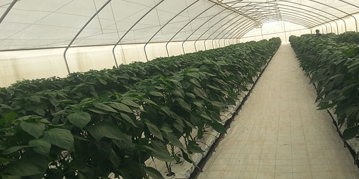
The Kumasi- Offinso Association comprises of Kumasi and Offin series and is developed from Cape Coast granite complex. They are suitable for both tree and arable crops. The Boamang-Suko Association has medium textures and is fairly low in nutrients. They have good characteristics for plant growth. Both soils are suitable for tree and arable crops such as oil palm, cocoa, citrus, plantain, maize, cassava and vegetables.
The Adujamso-Bechem Simple Association is developed from voltaian sandstone and is well drained and permeated. This is suitable for the cultivation of crops such as yam, cassava, maize, vegetables among others. The Bekwai-Oda Compound Association is deep and well drained and is similar to that of the Kumasi-Offinso Compound Association and is suitable for both tree and arable crops.
Impact of Human Activities including farming and bushfires
The activities of timber firms and chainsaw operators in the forest reserves have altered the natural environment considerably. The economic trees have been rapidly depleted. The slash and burn method of farming coupled with the perennial bushfires have also destroyed the ecosystem. Besides the forest cover, microorganisms in the soil have also been destroyed thereby rendering the lands quite infertile. This would invariably affect the water cycle. It has also led to the warming of the micro-climate and the altering of the rainfall pattern.
The once forest belt has witnessed the creeping in of the savannah mainly due to bushfires. The only notable savannah was around Amponsakrom, Gyamankrom, Adaankwanta, Asuafo and Apenten in the Nsenoa area. Bushfires are very conspicuous in Akomadan, Nkenkaasu, Darso, Kobreso, Asempanaye and Nsenoa areas. These were all once serious cocoa growing areas, but the perennial bushfires have made it impossible for farmers to replant their cocoa farms after the 1983 Bushfires that almost swept across the length and breadth of the country.
Another impact of human activity on the environment is the uncontrolled and improper application of fertilizer and agro-chemicals. The effect is that all the rivers and streams in the district have been contaminated. There is also a Sand winning activity at Darso. Even though the effect has not yet been noticed, it is worth putting in some restoration measures before it gets out of hand.
Aesthetic Features
The district has a few historical, scientific and aesthetic features which could be developed to serve as tourist attractions. These are the four (4) forest reserves; namely, the Afram Headwaters Forest Reserve (189.90km2), Afrensu-Brohoma Forest Reserve (89.06km2), Mankrang Forest Reserve (92.49km2) and the Opro River Forest Reserve (103.60km2)
There is also a waterfall around Akomadan. The highest point in the district which is around Papasisi is made up of sedimentary rock formations. This landmark has a lot of caves and it is believed that it used to be the abode of fairies (dwarfs) before the 1983 bushfires. The area is currently grassland.
Land Management
The lands in the district are of communal ownership with titles vested in the paramount stool and individual family heads. The District Assembly however, exercises spatial control through the Department of Town and Country Planning which is mandated to manage the spatial development of settlements by planned schemes/layouts. As a planning authority the district assembly ensures that water points and sanitation sites within the planned areas are adequately protected from encroachment.
Implications for Development
The phenomena described above have a myriad of implications for the development of the district. These have been outlined as follows;
• Streams have dried up because vegetative covers on watersheds have been cleared as a result of farming and lumbering activities.
• The slash and burn method of farming has contributed to the depletion of the forest cover as well as the destruction of micro-organisms in the soil. This has affected the fertility of the land culminating in low crop yields.
• The absence of layout schemes has resulted in unplanned development. The result is that there are no well-developed lanes in between houses that could be used for rescue in times of emergencies and disasters.
• The absence of layout schemes has also led to the loss of revenue to the Assembly in terms of property rates.
• The poor road network is not opening up the district for trade and investment.
• The improper application of fertilizer and other agro-chemicals has resulted in the contamination of water bodies and this has serious health implications for the people.
• The inadequacy of sanitary facilities has serious implication for environmental purity and therefore on the health of the people.
• The perennial bushfires have limited the capacity of the people to replant their cocoa farms and to venture into other cash crops the returns of which would have led to increased incomes.
Date Created : 11/25/2017 5:36:08 AM


 facebook
 X
X
 Youtube
 instagram
 +233 593 831 280
 0800 430 430
 GPS: GE-231-4383
 info@ghanadistricts.com
 Box GP1044, Accra, Ghana