
Location and Size
It covers a total land area of 8,353 Km2, representing 12% of the total landmass of the Northern Region. The Central Gonja District is located at the southern end of the Northern Region of Ghana. It shares boundaries in the north with the Tamale Metropolis, the Kintampo North District of the Brong-Ahafo Region in the south, East Gonja District in the East and the West Gonja District in the West.
Relative humidity is between 70% and 90% during the rainy season but is as low as 20% during the long dry season. Though the rainy pattern constitutes a major limiting factor affecting agricultural activities in the district, rainfall in the district is relatively more stable and reliable than most districts in the Northern Region.
Topology and Drainage
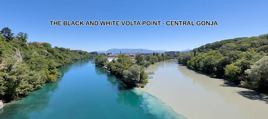
The land form of the district is low 1ying but gently undulating a t altitudes ranging between 150m-300m above sea level though some parts average 600m. The area is traversed by two major rivers - the White Volta, which flows longitudinally through the district, and the Black Volta, which forms the district’s southern boundary with the Kintampo North District. A lot of streams crisscross the district and flow into the two Volta Rivers.
The Central Gonja District lies within the tropical continental zone. Annual rainfall is unevenly distributed and limited to six months that is, from May to October. The mean annual rainfall ranges between 1000mm and 1500 mm with its peak in September. It has a slightly longer rainy season than the rest of the northern region.
Climate and Vegetation
Temperatures are generally high and exhibit seasonal variation. The district has a mean annual temperature of 35°C with the maximum temperature of about 40°C usually recorded around March-April. Temperatures are lowest, on average 22°C, between November and January due to the influence of the north-easterly winds otherwise known as harmattan.
Geology and Soil
Soil types found in the district are alluvial, laterite and savanna ochrosols. Alluvial soils are potentially fertile and are mostly found along the two Volta Rivers, their tributaries and the large plains.
The Yakumbo Forest Reserve, which covers an area of 1,200 hectares, is the only Reserve in the district. It has potential for the production of durable wood for construction and energy
Date Created : 11/30/2017 2:15:28 AM


 facebook
 X
X
 Youtube
 instagram
 +233 593 831 280
 0800 430 430
 GPS: GE-231-4383
 info@ghanadistricts.com
 Box GP1044, Accra, Ghana