- Item


- District Sublinks
- Other Links
- Other Officers
- Item
Location
In 1930, the Sekondi Town Council was created to administer the development of the area under Town Council Ordinance No. 26. In 1946, the Takoradi area was joined to the Sekondi Town Council as one administrative council. By June 1962, the Sekondi-Takoradi Town Council was elevated to a Metropolitan Assembly.
The name was changed to Shama Ahanta East Metropolitan Assembly (SAEMA) through a Legislative Instrument (LI) 1316 in 1994. However, in 2008 the name was changed to Sekondi-Takoradi Metropolitan Assembly (STMA) through an LI 1928 after Shama was elevated as a District. The Sekondi Takoradi Metropolitan Assembly is located in the southern part of the Western Region with Sekondi as the administrative capital. It is about 280 Km from Accra and 130km from La Cote D’Ivoire.
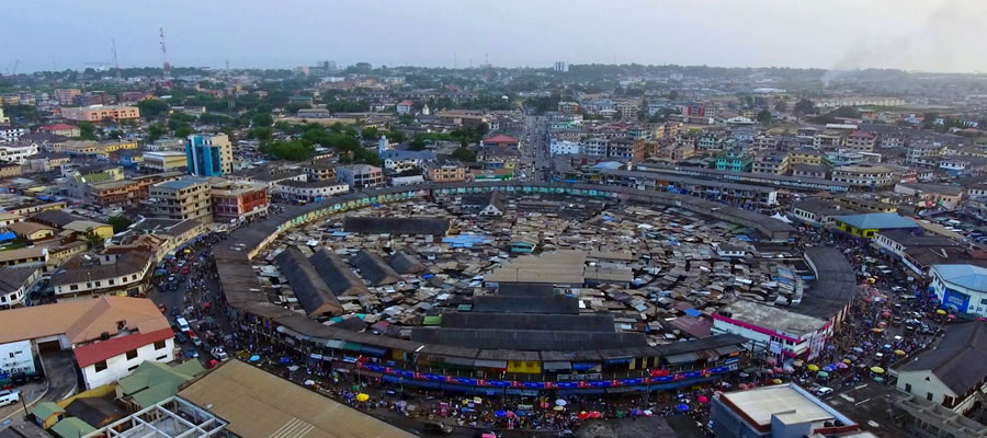
It is bordered to the North by Mpohor District, Shama District to the east, EffiaKwesimintsim Municipal to the west and south by the Gulf of Guinea. The position of STMA along the proposed Abidjan –Legos corridor highway is strategic and can serve as a transportation hub and a haulage truck terminal with all its advantages STMA is one of the fourteen (14) districts in the western region and has a total land area of 119 square kilometres. Though it is the smallest in terms of land size, it is the most urbanized and densely populated local government area in the Region.
Rapid urbanisation has put a greater burden on the Metropolis in terms of the provision of urban infrastructure and services. To effectively make use of available land for development effort is directed towards the adoption of effective land administration and management in the Medium-term. Preference would be given to the construction of high-rise apartments and other socio-economic infrastructure. 1.2.2 Topography/Drainage The central area of STMA has an altitude of 6m above sea level which is low lying. The low-lying areas in the Metropolis are interspersed with ridges and hills ranging from 30m – 60m high.
The highest points of the city provide a panoramic view of the Metropolis. There are five (5) major drainage basins namely Pokuantra, Kansawura, Buwen, Anankwari and Whin in the Sekondi Takoradi Metropolis and a minor river basin at Ngyiresia. The Anankwari River, which is located to the east of the Metropolis, runs through the village of Eshiem.
The area coverage of the Butre lagoon in 2010 was estimated at 86,404 (sq. meters) whilst Essei lagoon covered an area of 110,902 (sq. meters). The Whin estuary spanned an area of 652,202 (sq. meters). The general low-lying nature of the topography especially in the coastal areas is a key challenge as heavy rains results in frequent flooding and as a result increase in pressure on storm drain infrastructure for vantage points of the Metropolis to avert flooding.
Climate
The average annual temperature of the Metropolis is 22 oC. The mean annual rainfall is about 1,380mm and covers an average of 122 rainy days. There are two rainy seasons, namely the major and the minor. 70% of the rainfall occurs in the major rainy season which is the month of March to July. These rains are sometimes accompanied by storms and slight thunderous activities. The minor rainy season in the metropolis is from September to November.
It is short and severe and this leads to flooding in most of the communities in the metropolis. The dry seasons are short and pronounced which occur from August to September and a more extended one from December to February which ends as the Harmattan. The weather condition provides a propitious environment for aquaculture and crop production in the metropolis. In addition to the serene atmosphere, the metropolis is also favorable as a tourist attraction destination.
This can be achieved through enhancing both the natural resources and old human settlement development for local and foreign investment. There is an issue of severe rainfall and a low lying of the coastal area which is below sea level. This normally results in frequent flooding. Nevertheless, there is a favorable weather condition for aquaculture and crop production and the climatic conditions are conducive and attractive to tourists.
Vegetation
The Metropolis has three main vegetation types, namely, mangrove, coastal scrub and savannah woodland The Mangrove and coastal scrub are found in the southern and middle parts whilst the savannah woodland is found in the northern part respectively.
Geology
Geologically, shales and sandstones are the major rock types in STMA. These rocks are found on hard basement of granites, gneiss and schists. The landform of the coastline has been influenced by the faulting system. The water table is high and has a relatively high salt content on groundwater. This situation calls for adequate soil investigation before embarking on major infrastructure development. Most of these stone deposits are mainly found in Diabenekrom, Essipon, Kojokrom and Butumajebu. However, most of these sites have been encroached by private residential accommodation making it dangerous to the mining of the stones for construction purposes.
The situation has resulted in a high cost of quarry materials thereby making construction cost high. There is the need for the Town and Country Planning Department to clearly demarcate the places that are yet to be developed and create buffers to prevent the development of residential and other industrial properties close to the sites for stone mining.
Date Created : 11/21/2017 2:07:53 AM


Local Gov Ministry
Int of Local Gov Studies
Ministry of Information
Local Gov Service
Ghana MPs
Ghana Hospitals
NALAG
 facebook
 X
X
 Youtube
 instagram
 whatsapp
 +233 593 831 280
+233 20 230 9497
+233 593 831 280
+233 20 230 9497 0800 430 430
 GPS: GE-231-4383
 info@ghanadistricts.com
 Box GP1044, Accra, Ghana