

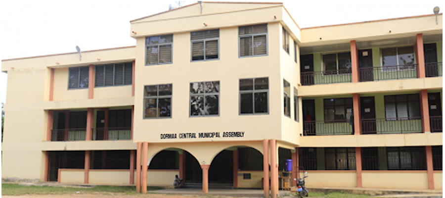
The Dormaa Central Municipal is located at the Western part of the Brong Ahafo Region. It lies within longitudes 3o West and 3o 30’ West and latitudes 7o North and 7o 30’ North. Jaman and Berekum Districts bound the Municipality on the north, on the east by the Sunyani Municipal, in the South and southeast by Asunafo and Asutifi Districts respectively, in the southwest by Western Region and in the West and northwest by la Cote d’Ivoire The District Capital is Dormaa Ahenkro, located about 80 kilometres west of the regional capital, Sunyani.
The Municipality has a total land area of 1,368 square kilometres, which is about 3.5 percent of the total land area of Brong Ahafo Region and about 0.6 percent of that of the country. It has 345 settlements, one traditional authority and two constituencies, namely: Dormaa East and Dormaa West.
The Municipal’s topography is generally undulating and rises between 180 metres and 375 metres above sea level. The high range can be found near Asunsu in the north-western part of the district most of which is occupied by the Pamu-Berekum Forest Reserve. The highest point is a little over 375 metres above sea level. The medium range rises gradually between 240 metres and 300 metres above sea level. Some of the towns found on this range are Dormaa Ahenkro, Gonokrom, Wamfie and Biaso.
This range stretches from the northwest to the northeast. The lowland range occupies the southern part of the district. Some of the towns in this area include Nkrankwanta, Diabakrom and Adiembra. The general height is between 180 metres and 240 metres above sea level.
The drainage pattern of Dormaa Municipal is basically dendritic and flows in the north-south direction. Most of the rivers have catchments areas within the district around the high range near Asunsu with only a few taking their sources from the Jaman and Berekum Districts. The area is well drained as evidenced by the dense network of rivers spread out over the district. The rivers are mostly perennial due to the double maximal – rainfall, which is experienced in the district. Notable among them are the Bia, Nkasapim and Pamu rivers.
Dormaa Municipal is located within the wet semi-equatorial climate region with a double maximal rainfall regime. The mean annual rainfall is between 125cm and 175cm. The first rainy season is from May to June; with the heaviest rainfall occurring in June while the second rainy season is from September to October. The dry seasons are quite pronounced with the main season beginning around the latter part of November and ending in February. It is often accompanied by relative humidity of 75 – 80 percent during the two rainy seasons and 70 – 72 percent during the rest of the year.
The highest mean temperature of the district is about 30ºC and occurs between March and April and the lowest about 26.1ºC in August. he major vegetation types are the unused forest, broken forest, grassland and extensively cultivable forestland and forest reserves The unused forest is located at the extreme northeast where it extends to Sunyani and Asutifi Districts. The forest reserves are Mpameso (197.67 square kilometres), Pamu-Berekum (116.80 square kilometres)) and Tain II (297.6 square kilometres).
The Mpameso forest reserve is located at the south of the district, Pamu-Berekum at the northwest and Tain II at the west of the district extending to Sunyani and Asutifi Districts. The major types of flora found in these forests range from shrubs and climbers to giant silk cotton trees. Timber species including Wawa (Tripolichiton Scleroxylon), Odum (Milicia excelsa), Sapele (Guthagrophrama) and Mahogany (Khaya invernesses) are found here.
The broken forest is located at the extreme southwest, where it extends to Juabeso-Bia District and la Cote D’lvoire. This type of vegetation is also found at the northern fringes of the Mpameso forest reserve. It is characterised by forest interspersed with grassland. The major plant types include elephant grass, shrubs and a few scattered trees with heights ranging between 15m and 28m high. The forest has been extensively cultivated leading to an invasion of grassland vegetation.
The extensively cultivable forest occupies the north, central, western and southern part of the district. The vegetation is dominated by elephant grass and a few short trees scattered all over the area. <p>As a result of the farming activities in the district, these vegetation types are threatened and the forests, for instance, keep on changing to grassland.
The rocks underlying the soils are of the Birimian formation which covers more than three quarters of the closed forest zone. Economically, it is the most important geological formation in Ghana since it contains all the minerals exported from the country such as gold, diamond, bauxite and manganese. Associated with the Birimian formation are extensive masses of, granite which occur in parallel belts.
Soils in the district belong to the Bekwai-Nzema Compound Associations. The Nkrankwanta Association dominates the south-western section of the district. The Nzema series, which are made up of quartz gravels and ironstone are moderately well-drained. These soil types tend to support both industrial and food crops, which include cocoa, coffee, oil palm, citrus, cola-nuts, plantain, cassava and maize.
Date Created : 11/16/2017 1:13:47 AM








 facebook
 X
X
 Youtube
 instagram
 +233 593 831 280
 0800 430 430
 GPS: GE-231-4383
 info@ghanadistricts.com
 Box GP1044, Accra, Ghana