- Item


Physical Features
Location and size
The Fanteakwa district is located within the central part of the Eastern Region of Ghana. It lies within longitudes 0032.5’ west and latitudes 6015’north and 6010’ south. The district shares boundaries with Kwahu Afram Plains South district to the north, to the northwest by Kwahu South district, the south by East Akim and Atiwa district and to the east by Yilo and Upper Manya Krobo district. It is bonded to the north by the Afram Plains and Volta Lake and to the North West. The district has a total land area of 1150 square kilometers being currently the third largest district in the region in terms of land size.
Climate
The district falls under the influence of both the south west monsoon winds and north east trade winds and characterized by double maxima rainfall in March to October and November to February respectively with the heaviest rainfall in June. Averagely, the district experiences an annual temperature of 24 degrees Celsius, with the weather usually cold and often experience relative humidity throughout the year. This condition therefore resulted in the district popularly known as ‘Manchester’.
Vegetation
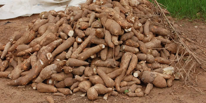
The district is predominantly a forest zone with few semi-savannah areas at the Northern part. The typical wet- semi deciduous forest vegetation covers about 80 percent of the total vegetation cover across the district. This vegetation is therefore suitable for the cultivation of cash crops like cocoa, coffee, rubber, oil palm and citrus as well as stable food crops such as plantain, cocoyam, cassava, maize, rice and vegetables. Most of these crops are exported which help generate more income for farmers, the district and the country as a whole.
Relief and Drainage
The topography of the district is generally hilly and rugged with undulating land forms. The average height of the land is about 8762m above sea level. Underlying these land masses are several rocks and parent rocks from which several different soils have developed. The parent rock includes the Birrimian formation and Voltarian metamorphoses sediment, with their associated rocks such as Phyllis, Schist and Granites. Most of the hills are capped with iron pans, Bauxite and Kaolin. Gold and Bauxite are also embedded within these rocks. They are suitable for both building and constructional purposes and can therefore be exploited to the benefit of the district.
The district is well drained with several rivers such as the Akrum, Osubin, Amanfuesua and Dede. Almost all these rivers are seasonal with most of them overflowing their banks during the rainy season and drying up during the dry season. These rivers are the major source of water resources used mainly for domestic activities.
Apart from the vast arable land being used mainly for agricultural purposes, the topographical and geological nature of the vegetation in the district also made possible for a proportion of the land being used for some small scale mining activities across the southern part (Abompe, Osino, Nsuapemso, etc) of the district. The rocks found in the district are also suitable for both building and constructional purposes and are therefore being exploited to the benefit of residents in the district.
Date Created : 11/24/2017 3:56:52 AM


Local Gov Ministry
Int of Local Gov Studies
Ministry of Information
Local Gov Service
Ghana MPs
Ghana Hospitals
NALAG
 facebook
 twitter
 Youtube
 +233 593 831 280
+233 20 230 9497
+233 593 831 280
+233 20 230 9497 0800 430 430
 GPS: GE-231-4383
 info@ghanadistricts.com
 Box GP1044, Accra, Ghana