- Item


Mission
To work towards eradicating endemic poverty by creating a conducive atmosphere for behavioural and attitudinal change particularly among the unemployed youth to stem the tide of rural-urban migration.
Background and History
Bongo District lies in the northern tip of Ghana’s Upper East Region, nine miles from Bolgatanga, the capital of the Upper East Region. It shares boundaries with Burkina Faso in the north, Talensi Nabdam in the east, Kassena-Nankani in the west and Bolgatanga in the south.
The small town of Bongo and its environs are littered with rocks which occupy almost a third of the total land space. The rocks are sedimentary and have been there since creation; spectacular and breathtaking, one on top of the other. The name Bongo came about as a result of the discovery of a large but harmless python that patrolled the town at night. It was believed to be a god of protection. The word python in Mamprusi is bohugu and in Frafra bahine, interpreted by Europeans who had difficulty with pronunciation, as Bongo.
Sites of Interest
Bongo is endowed with significant sites of interest. There are for example, the rocky hills called Apusariga and Azuruo. These formed the defence wall of our ancestors. Bongo area was once occupied by Busansis who were later driven away by the Mamprusis who later settled there. Within the hills are many caves and crevices which gave much needed hideouts. At Asikuliga there is the grave of the first chief and founder of Bongo as well as the stone on which he sat to perform his duties.
The very first settlement area of the Mamprusi warriors is Abongin. From here they organised and drove away the Busansis by the use of fire torches at night. Today, this is celebrated annually as an ancestral fire festival known as ‘Azambene’. Another site of interest is Abeneba, a restricted shrine in Adaboya inhabited by a sacred tiger. Here, all the enskined Bongo chiefs are washed and purified before entering Bongo.
Situation Analysis
Bongo District is the poorest and most deprived among the eight districts of the region and this is well documented. The adverse climatic and environmental conditions contribute to the endemic poverty in the area. In spite of pilot poverty reduction projects by both government and NGOs, the socio-economic status of the people is still low compared to the other parts of the region and the country at large. The majority of people in the district are engaged in subsistence farming, but the short rainfall pattern allows only one harvest per year. The main economic activities, mostly carried out by women, are the weaving of baskets and hats as well as cloth weaving, production of pottery and shea butter processing.
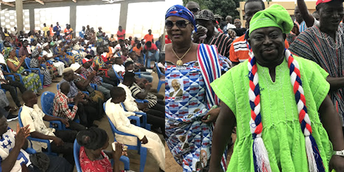
Although Bongo has a major road passing through it to Burkina Faso, it is not tarred most of the bridges along the road have no bridges. Whilst tourists do not pass through enroute to other destinations we believe that Bongo is a worthwhile destination in itself. For the first time however, Bongo has a literate chief who is pro-active in the development of the area. He believes that a project such as the one being proposed will enable people to understand the importance of education in the job market. The understanding that education is the key to success is likely to lead to socio-economic development.
Project Vision
To alleviate and reduce poverty by creating employment through sustainable tourism.
Aims
- To encourage tourists to visit Bongo District by providing facilities for them.
- To do this in a manner that will not destroy the very environment and culture which they are coming to experience, hence the title ‘Eco-Tourist Project’.
To create a variety of jobs, full time and part time, for as many people as possible
Date Created : 11/18/2017 6:01:30 AM


Local Gov Ministry
Int of Local Gov Studies
Ministry of Information
Local Gov Service
Ghana MPs
Ghana Hospitals
NALAG
 facebook
 twitter
 Youtube
 +233 593 831 280
+233 20 230 9497
+233 593 831 280
+233 20 230 9497 0800 430 430
 GPS: GE-231-4383
 info@ghanadistricts.com
 Box GP1044, Accra, Ghana