Location & Size
The Shai Osudoku District is situated in the Southeastern part of Ghana, lying between latitude 5° 45’ south and 6° 05’ North and Longitude 0° 05’ East and 0° 20’ West. The District has a total land area of 1,442 square kilometres, making it the largest in the Greater Accra Region. The land size represents 41.5% of the regional land area.
The district was carved out of the former District in 1988 as a result of a national redemarcation exercise carried out in relation to decentralization reforms in the country. The district shares boundaries with the Yilo Krobo District on the North-West, North-Tongu District on the North-East, Akwapim-North District on the West, Tema District on the South-West and Shai Osudoku District on the East.
The north-eastern and the southern portions of the district are washed by the Volta River and the Atlantic Ocean respectively. The district has a coastline stretching over 37 kilometres.
Topology & Drainage
Topography
The district forms the central portions of the Accra plains. The relief is generally gentle and undulating, a low plain with heights not exceeding 70 metres. The plains are punctuated in isolated areas by a few prominent inselbergs, isolated hills, outliers and knolls scattered erratically over the area.
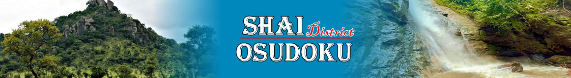
Prominent relief features include the Yongua inselberg (427 metres) which appears conical in the air with a number of outliers close to the north of the district around Asutsuare and Osuwem areas; the Krabote inselberg also to the North and the Shai Hills (289 metres) found towards the western portions of the district.
Large rock outcrops and boulders are conspicuously placed in the vicinity of the hills in certain places. The rocky hills together with the large boulders provide immense potentials for stone quarrying, which is already a major pre-occupation in the district.The Akwapim mountain range in the northwestern parts of the district presents a striking relief feature of outstanding natural beauty. It also accounts for a icro- rain shadow effect that influences the climate of Dodowa and the immediate surroundings.The eastern foothills of the range have fairly deep well-drained and relatively fertile hilly soils. The foothills constitute one of the most largely cropped Dortions of the district.
Drainage
The general pattern of drainage in the Shai Osudoku District is dendritic with most of the streams taking their source from the Akwapim range which is also serving as a watershed and then flow in a northwest to southwest direction into lagoons on the coast.Flowing over a fairly low terrain, most of the streams have carved wide valleys for themselves, which are left dry for most parts of the year.
The very seasonal nature of most of the streams caused by high emperatures and equally high insulation levels have encouraged the creation of a number of artificial dams and ponds of varying size, used for irrigation and for the watering of livestock.
Prominent among these are the Volta River Dam at Natriku, Dawhenya Dam on the Dekyidor stream at Dawhenya both of which provides ample water for irrigation farming. Other smaller dams include those at Agortor, Fiakonya and Odumse.The extreme northeastern portions of the district forms part of the lower Volta flood plain.
The repeated process of flooding and recession of the Volta waters over the years have left behind fertile alluvial soils, a fairly vast sedimentary strata of oyster shells and a number of inland lakes notably the Kasu, Nyapia, Dzipor and Nyatia lakes all located within the marshy basin of the Narbayi stream.Ground water potentials in the district are quiet low and saline. The greater part of the district therefore relies on pipe-borne water from Kpong.
Climate & Vegetation
Climate
The Southeastern coastal plain of Ghana, which encompasses the Shai Osudoku District, is one of the hottest and driest parts of the country. Temperatures are however subjected to occasional and minimal moderating influences along the coast and altitudinal influences affected by the Akwapim range in the northwest.
Temperatures are appreciably high for most parts of the year with the highest during the main dry season (November - March) and lowest during the short dry season (July - August). They average a few degrees lower on the coast and close to the Akwapim range than they do over most of the plains. The absolute maximum temperature is 40° C.
The most complete absence of cloud cover for most parts of the year gives way to very high rates of evaporation which leaves most parts of the district dry and with parched soils. The combined effects of high temperatures and high insulation levels, on the other hand, are of invaluable asset to the salt-making industry, as they account for the high and rapid rates of salinization and crystallization crucial for the winning of salt. They also provide enormous potentials for solar power development.
Rainfall is generally very low with most of the rains, very erratic in nature and coming mostly between September and November. Mean annual rainfall increases from 762.5 millilitres on the coast to 1220 millilitres to the North and Northeast close to the foothills of Akwapim Rang and on the summit.
The unreliability and dependence of farmers on the rainy seasons makes farming a vulnerable occupation. Periodic main crop failures are common phenomena even in the better- watered northern parts. It is obvious therefore that the provision of irrigation facilities would be of great value in the district. This should be accompanied by soil salinit control measures.
Vegetation
The predominant vegetation type found in the district is of the short grass savannah interspersed with shrubs and short trees, a characteristic of the Sub- Sahelin type. A large portion of vegetation remains dry for most parts of the year particularly towards the south except for the short rainy season.The ravaging effects of seasonal bushfires that sweep across most parts of the district especially during the dry season further depreciate the quality of the vegetation.
Along some stream courses, however, higher vegetation type ranging from thickets to light forest are common. Some light forest with tall trees is also found along the foothills of the Akwapim Range especially around Dodowa, Ayikuma and Agomeda areas. There is a Forest and Game and Wildlife Reserve around the Shai hills.
Large strands of Borassus Palm are found around the eastern portions of Dodowa and Ayikuma. Isolated stands of baobab trees are common all over the plain. In the Volta flood plain areas, tall swampy grass and tall grass savannah with isolated patches of thicket and trees represent the main vegetation type.
Geology & Soil
Geology
Ancient igneous rocks underly the major part of the district. Strongly metamorphosed ancient sediments occur along the western boundary. There are also important areas of relatively young unconsolidated sediments in the south and southeast. Dahomeyan gneiss and schist’s occupy most of the plains proper. Basic gneiss forms a number of large inselbergs (isolated rocky hills) in the north and center of the belt.
Small rock outcrops are also common in the north close to the inselbergs but are rare in south and southeast. The eastern belt of acidic gneiss consists mainly of the grained metamorphosed rocks rather richer in minerals than the rocks in the western belt and with many fewer quarts veins.
Recent alluvium occupies the Volta flood plains and the valleys of the major streams on the plain. There are no known mineral deposition of commercial and economic value in the area, except for oyster shell deposits at Volivo and its surroundings and clays of various types occurring in different places used for pottery and for the making of tiles and bricks.
Soils And Suitability For Agriculture
The predominant soil types in the district are the black clays classified as Akuse series and occupies the central to eastern parts of the district. The soils are highly elastic when wet but become hard and compact when dry and then crack vertically from the surface. This renders the soil unsuitable for hand cultivation.
Cultivation in the Akuse series dominated areas is confined mainly to small amounts of subsistence cropping of cassava, okro, maize and other vegetables. The short type grassland covering the Akuse series provides extensive grazing fields.The Black clays are considered highly suitable for development mechanized irrigation farming. At the gentle foot slopes of the Akwapim Range north of Dodowa, Agomeda and Ayikuma occurs an accumulation of slope wash from the hills.
The slope wash material consists predominantly of the Oyarifa series. These are deep, red, well-drained loamy soils. Here crops such as cassava, cocoyam and to a larger extent maize are best suited. Mangoes are also largely grown in the Dodowa areas
The soil types, which occur further east of Dodowa, within the Doryumu and Kordiabe areas, are of the Simpa-Doryumu-Agortor-Association.
These are brownish gray, slight humus, medium or coarse sand, underlain by a hard porous gristly loam.The soils have low nutritional status and are quick in becoming parched after the end of the rainy season. Main crops grown here include pepper, okro, watermelon and maize.
Other soil types identifiable are those classified locally as the Agortor series found on the extreme eastern to south-eastern part of the district around Agortor, Dawa and Minya.The soil here consists of gray-brown soils loamy for about 15-30 centimeter the surface than abruptly changing to an impervious clay which contains lime concretion below a depth of 60 centimeters. The topsoil rapidly becomes draughty during the dry seasons.
This type of soil fairly supports any level of crop production. Most parts of the area are, however, left for grazing purposes. In the extreme north and northeast of the district occurs the Volta Alluvium, which makes up the Volta flood plain.The soils classified as an association of Amo and Tefle series consists more or less have poorly drained pale-coloured sandy silty and clay soils developed in recent or contemporary Volta Alluvium.
The soils appear to be moderately well supplied with nutrients under natural conditions and are easily workable even with simple implements. A greater portion of it in recent past was placed under extensive sugar cane cultivation to feed the now collapsed Asutsuare Sugar Factory.
The same fields are currently place under extensive rice cultivation making the flood plain soils, one of the most fertile soils in the Dangme West District.At the coastal south, the predominant soil type is associated with coastal sand dunes, backed by a discontinuous series of narrow, saline or brackish lagoons. These soils to some extent support coconut growth.
Lastly, the type of soils classified as Toje-Agortor series covers the area along the road to Ada and located at the southern sections of the Agortor series. It is made up of a mixture of red soils developed over tertiary deposits on the uplands and gray-brown impervious clays of Agortor series. These soils absorb moisture freely except when left bare.
Under the prevailing climatic conditions, they tend to be draughty in the topsoil, but lower layers have a good moisture storage capacity. These soils, to some extent, are favoured for cultivation as they are easily workable.However, the application of frequent cover crops or the addition of farmyard manure will be essential if intensified crop production is to be maintained.
Date Created : 11/28/2017 5:50:44 AM


- District Sublinks
- Other Links
- Other Officers
- Downloads
- Saboba: Compensation 2022

 facebook
 X (twitter)
 Youtube
 +233 593 831 280
 0800 430 430
 GPS: GE-231-4383
 info@ghanadistricts.com
 Box GP1044, Accra, Ghana